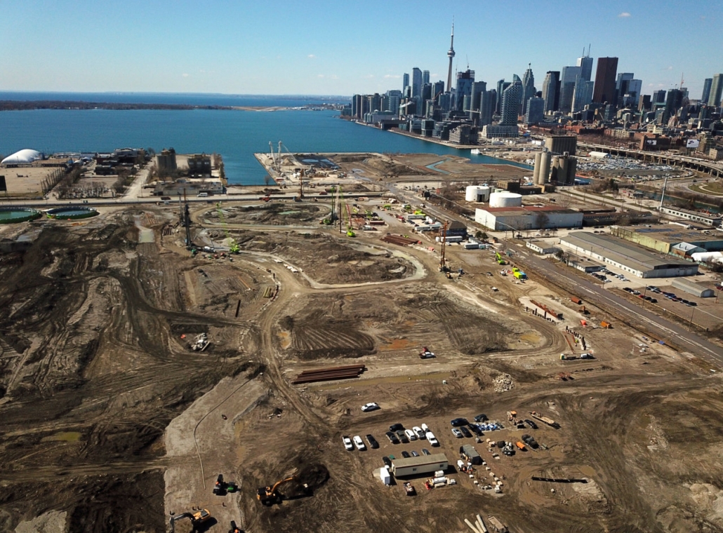
Generations after the lower stretch of Don River and its mouth into Lake Ontario was straightened and channelized for industry, the mistakes of the past are being corrected. The undoing of what was called the ‘Don Improvement Project’—from a time when environmental issues were not well understood—is part of Waterfront Toronto’s wider redevelopment of Toronto’s Port Lands.
While re-naturalizing the Don River’s mouth with a new curving channel, the current work creates an island by separating the northwest chunk of the Port Lands from the mainland. To be known as Villiers Island for its main east-west street, the area is being decontaminated, provided with infrastructure to house people, and will be surrounded by new parkland.

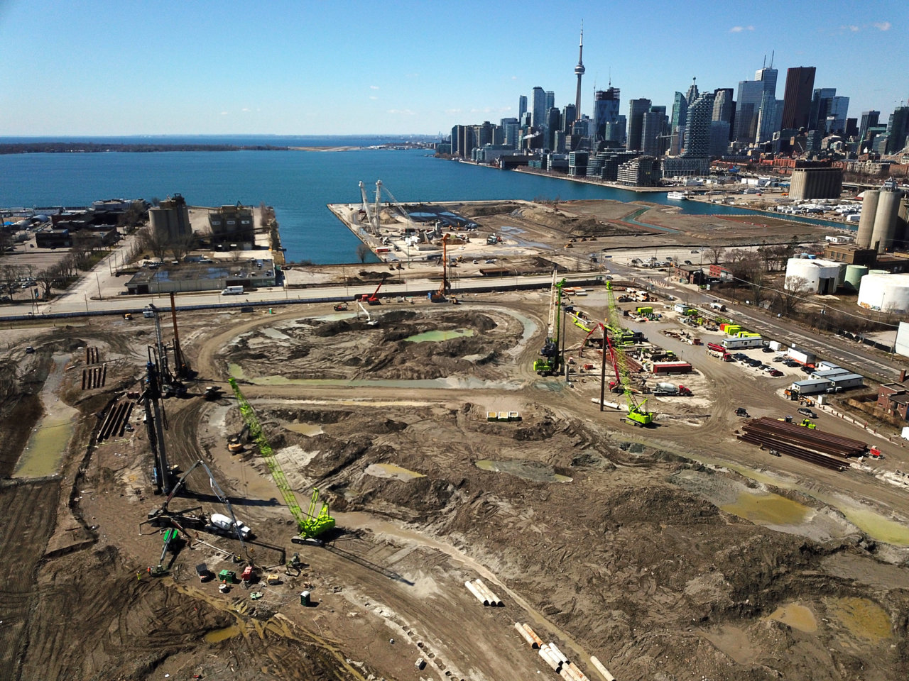
To create new parkland alongside Toronto Harbour, Waterfront Toronto has been undertaking the Cherry Street Lakefilling project. It commenced in winter 2017 and has now wrapped up. An element of the Port Lands Flood Protection Project, the lakefilling process formed new land around Essroc Quay, replacing its hard edges with a more natural shoreline for the northwest corner of Villiers Island. (Essroc manufactures cement, and will be moving its operations eventually.)
The lake filling work is best summarized in a brief time-lapse video released by Waterfront Toronto last month.
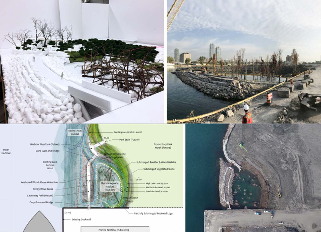
Certain elements of Villiers Island shown in pre-construction renderings and models are now starting to materialize. One area known as the ‘fish cove’ is located at the west end of the island, and is protected bay divided from the lake by a fish gate, and traversed by a pedestrian bridge. This and some other features have been designed to bring wildlife back to the mouth of the Don, looking to undo decades of industrial damage to the area.
The first bit of new road infrastructure for the area is now in its earliest stages: the existing Cherry Street lift bridge—which showed its age during a lengthy malfunction last summer—is to be replaced. Construction of foundation piers and preliminary earthworks are in full swing for the new Cherry Street North Bridge, which moves the major north-south roadway in the Port Lands onto a new alignment further west.


 Maziar Moini, Broker of Record - Home Leader Realty Inc.
300 Richmond St. W., #300, Toronto, ON M5V-1X2
Maziar Moini, Broker of Record - Home Leader Realty Inc.
300 Richmond St. W., #300, Toronto, ON M5V-1X2